In this guide: The headline vs. the forecast · What this weekend actually looks like · Why this storm isn't El Niño · The real El Niño numbers · What it means for your home · The weekend checklist · Quick answers
My phone started buzzing Monday with some version of the same question: is an El Niño storm really about to hit Newport Beach over the holiday weekend? The headlines are doing two jobs at once right now, and it is worth pulling them apart, because one story is about this weekend and the other is about this entire winter. They are not the same storm. One of them matters a lot more to homeowners here than the other.
The headline vs. the forecast
The storm in the news this week is Tropical Storm Marie, a system that formed off the coast of Mexico and, as of the National Hurricane Center's Tuesday night advisory, carried maximum sustained winds of 65 mph roughly 470 miles south of the Baja peninsula, moving northwest and forecast to strengthen into a hurricane by midweek. Some forecast models bring its moisture close enough to Southern California to matter over Labor Day weekend. Others turn it west into the open Pacific.
Here is the part the loudest headlines skip: the National Weather Service has called significant wind and rain from this system the least likely outcome for our weekend. A CBS Los Angeles weather producer put it plainly: everything would have to go perfectly wrong for a tropical storm to batter Southern California. That is not zero, and forecasts genuinely can shift day to day, but it is a long way from the storm-of-the-decade framing making the rounds.
What this weekend actually looks like in Newport
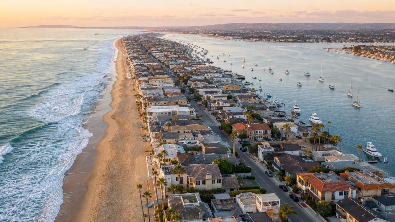
What Marie will almost certainly send us is surf. The hurricane center expects her swells to spread up to Southern California by the weekend, with life-threatening surf and rip current conditions along the way. In Newport Beach that means the south-facing shores, the Balboa Peninsula and the 92661 stretch that ends at the Wedge, are the ones to watch. Evening high tides are forecast to approach seven feet by Monday, and forecasters see a moderate chance of coastal flooding on south-facing beaches when big swell and a high tide line up.
Scenario | Forecast confidence |
Large waves and strong rip currents | High chance |
Coastal flooding on south-facing shores | Moderate chance |
Light rain at some point in the weekend | Most likely rain outcome |
Heavy rain of 2 inches or more | Roughly 5 to 10 percent |
Completely dry weekend | Roughly 20 to 30 percent |
Direct tropical storm impacts | Least likely outcome, per the NWS |
If you were planning a beach weekend, this does not cancel it. It moves it. The Wedge on a big south swell is one of the great free shows in Orange County, and watching from the sand is the local move. Swimming near it is not. Respect the lifeguards, keep kids close to the towers on the Peninsula, and if you want calmer water, the harbor side and the Back Bay do not care what the open ocean is doing. Our Labor Day weekend guide has a full plan for every crew, most of it comfortably indifferent to swell.
No, this weekend's storm is not El Niño
Marie is a tropical system, born in warm eastern Pacific water, the kind late summer produces in a normal year. El Niño is something else entirely: a slow, ocean-scale warming pattern along the equatorial Pacific that loads the dice for a wetter, stormier winter months from now. A tropical storm is a weekend event. El Niño is a season. The reason the two got tangled together in this week's coverage is timing: Los Angeles County held storm-preparedness briefings this week that covered both the holiday weekend system and the winter outlook in the same breath.
The real story is the winter forecast, and the numbers are unusual
Here is the part I would actually bookmark. NOAA now gives better than a 90 percent chance of a very strong El Niño this fall and winter, and roughly a 69 percent chance that the October-through-December event exceeds the strength of every El Niño on record since 1950. Forecasters have been using the phrase super El Niño without much hedging.
For context on what strong El Niño winters have done here: coastal Southern California averages about 14.25 inches of rain in a normal year. The 1997-98 El Niño delivered 30.57 inches. The 1982-83 event brought 33.19 inches. And the honest asterisk: the strong 2015-16 El Niño was forecast to soak California and largely did not. A loaded dice roll is still a dice roll. But county public works teams are treating this one seriously, staging debris-flow and flooding plans now, with particular attention to burn-scar areas.
What a super El Niño winter means for a coastal OC home
This is where a weather story becomes a real estate story. If the winter forecast verifies even partway, the homes that come through it comfortably are the ones that got boring maintenance done in the fall: roofs inspected, gutters and downspouts cleared, drainage that moves water away from the foundation, slopes and bluff-adjacent landscaping checked, window and door seals looked at along the salt-air line. None of that is glamorous. All of it is cheaper in October than in the middle of a January storm cycle.
If you are thinking about selling, the calendar matters this year more than most. The fall window between Labor Day and the first real rains is traditionally when serious coastal listings launch, and a genuinely wet winter can compress next spring's prep season. A home that shows dry, drained, and cared for in the rain earns trust that no staging can fake. If you are buying this winter, an El Niño season is oddly a gift: you will see every home at its worst, which is exactly when you want to evaluate one.
If a sale is anywhere on your horizon, start with a current read on your home's value and we can talk honestly about whether to move before the rains or after them. Watching the market instead? The September market updates are live with fresh numbers for Newport Beach, Costa Mesa, and Orange County.
The local's checklist for this weekend
Check the National Weather Service forecast Friday morning, not Wednesday's headlines, because this forecast will keep moving. Plan beach time for mornings and respect every rip current flag. Watch the Wedge from the sand if the swell arrives. Keep the harborside options in your back pocket. And if the weekend ends up sunny and flat, which the forecast says is entirely possible, enjoy the quietest good weekend of the summer.
Quick answers
Is the storm coming to Newport Beach this weekend an El Niño storm?
No. The weekend system is Tropical Storm Marie, a tropical storm off Mexico expected to strengthen into a hurricane and send large swells toward Southern California. El Niño is a separate ocean-warming pattern that shapes the coming winter. They are in the news at the same time, but they are different things on different clocks.
Will Tropical Storm Marie hit Southern California?
A direct hit is the least likely outcome, according to the National Weather Service. The most probable impacts for Newport Beach are large waves, strong rip currents, a moderate chance of coastal flooding on south-facing shores near the evening high tides, and possibly some light rain. Heavy rain of two inches or more carries only a 5 to 10 percent chance. Check the latest forecast before the weekend, because tropical systems can shift.
How strong will the 2026-27 El Niño be?
NOAA gives better than a 90 percent chance of a very strong El Niño this fall and winter, and about a 69 percent chance it becomes the strongest event on record since 1950. Past strong El Niños roughly doubled coastal Southern California's normal 14.25 inches of rain, though the 2015-16 event showed a strong forecast does not guarantee a wet result.
What should Orange County homeowners do before an El Niño winter?
Handle the unglamorous fall maintenance: roof inspection, cleared gutters and downspouts, drainage that carries water away from the foundation, a look at slopes and bluff-adjacent landscaping, and sealed windows and doors along the salt-air line. Sellers should also weigh the fall listing window, since a wet winter can compress the spring prep season.
A note from Jade: I will keep reading the forecasts so you don't have to refresh them all weekend. If you want to know about the homes that launch right after the holiday, before they reach the portals, my coming soon alerts will tell you first.
Forecast details in this post reflect National Hurricane Center and National Weather Service information as of Tuesday evening, September 1, and will change as the system develops. Check the NWS forecast before making weekend plans, and never swim near the Wedge during a south swell.
Jade Larney · Residential Real Estate | Anvil · (949) 995-JADE · [email protected] · DRE 02241676